


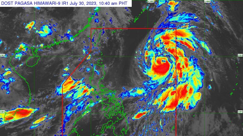
In their 11am advisory on July 30, meteorologists at the Philippine Atmospheric, Geophysical and Astronomical Services Administration (Pagasa) cautioned about the possibility of heavy rains, floods, and landslides in mountainous areas of the country.
Currently, Khanun is moving north-northwest with maximum sustained winds of 95 kph near the center and gustiness of up to 115 kph, according to Manila Times.
If the projections hold true, Khanun would be the third typhoon to strike China after the devastating Doksuri, which hit on Friday (July 28), and Typhoon Talim, just a week earlier, as reported by Reuters news agency.
After exiting the Philippines early next week, Typhoon Khanun is expected to shift its course to west-northwestward, passing close to Japan’s Okinawa Islands in the Ryukyu Archipelago on Tuesday (Aug 2) morning before entering the East China Sea.
Pagasa reports that the Philippines experiences an average of 20 tropical cyclones annually, making it one of the countries most severely affected by such storms worldwide.
Experts are attributing the increased intensity of storms in the Western Pacific, especially during August and September, to the effects of global warming. As climate change continues, scientists warn that storms could become more frequent and violent.